One app for the whole journey — from "where should we go?" to logging the send. Built for skydivers, divers, hikers, and climbers who want less guesswork and more airtime.
Real-time weather, terrain, visibility, surf, trail, and local insights — for wherever you're headed.
Real-time weather, terrain, visibility, surf, trail, and local insights before you go.

Real-time weather, terrain, visibility, surf, trail, and local insights before you go.

Real-time weather, terrain, visibility, surf, trail, and local insights before you go.
Jump-run spotting, winds aloft, and weather windows scored for canopy time.
Dive planning, conditions, and AI debriefs that capture every dive.
Routes, trail logistics, and GPX exports for navigation you can rely on.
Approach beta, weather, and group coordination for the whole crew.
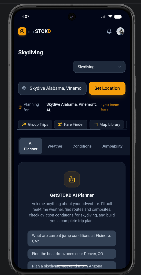
Describe what you want — a weekend of jumps, a multi-day approach, a dive trip — and the AI planner builds it: timing, routes, logistics, and gear, grounded in real conditions for your dates.
Not just a forecast — a verdict. GetStokd scores every window 0–100 using activity-specific models, so a thunderstorm afternoon and a glass-calm morning never look the same.
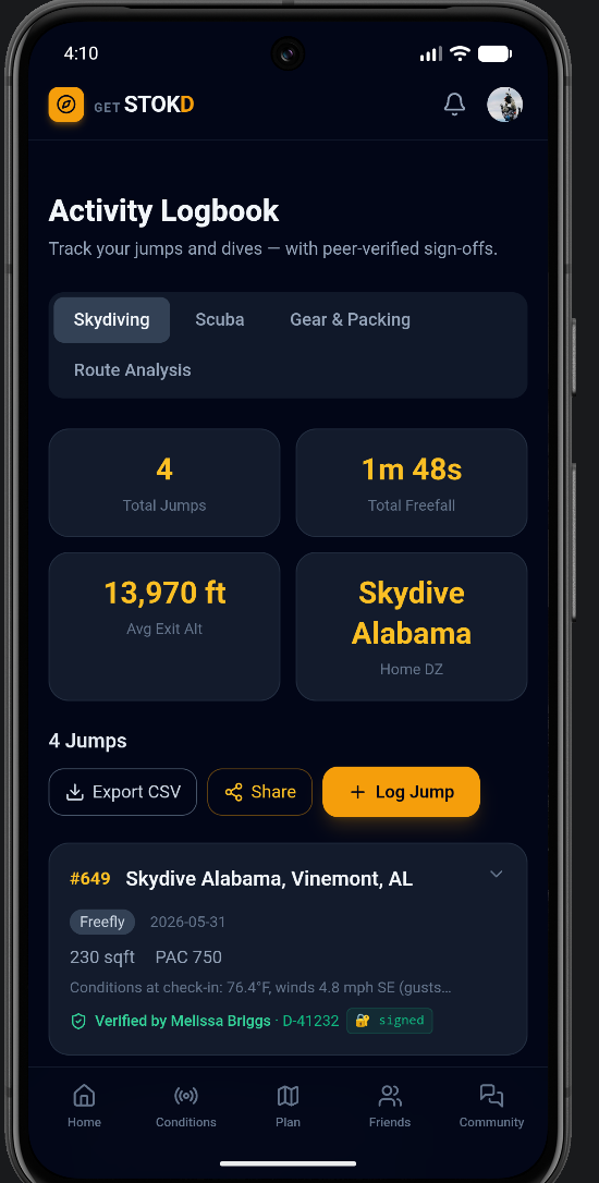
Track every jump, dive, and summit in a logbook that turns your history into smarter suggestions. Export precise GPX routes for the field, and plan group trips that keep the crew synced.
Plan it in minutes.